Limited Snowfall in Maryland During Fast-Moving Winter Storm

Baltimore, Maryland United States of America
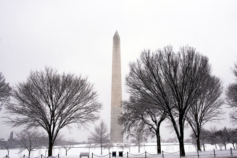
Due to factors such as warm temperatures when the storm started and ground that was not frozen, accumulation in Maryland was limited. The National Weather Service has issued a Winter Storm Warning for Baltimore, Carroll, Cecil and Harford counties as well as Baltimore City while Anne Arundel County remains under a Winter Storm Advisory.
Schools in these areas have canceled weekend activities due to the snow.
The winter storm that hit Maryland on Friday night into Saturday morning was a fast-moving one, but it did bring some snow to the state. The areas of Westminster, Reisterstown, Cockeysville and BWI-Marshall received 5 inches or more of snow while Clarksville got 2 inches.
Limited Snowfall in Maryland During Fast-Moving Winter Storm

The winter storm that hit Maryland on Friday night into Saturday morning was a fast-moving one, but it did bring some snow to the state. The areas of Westminster, Reisterstown, Cockeysville and BWI-Marshall received 5 inches or more of snow while Clarksville got 2 inches. However, due to factors such as warm temperatures when the storm started and ground that was not frozen, accumulation in Maryland was limited. The National Weather Service has issued a Winter Storm Warning for Baltimore, Carroll, Cecil and Harford counties as well as Baltimore City while Anne Arundel County remains under a Winter Storm Advisory. Schools in these areas have canceled weekend activities due to the snow.

Confidence

100%

No Doubts Found At Time Of Publication

Sources

69%

  • Unique Points
    • Generally, just a coating to a couple inches fell
    • The winter storm system has moved out of the DC area.
    • Residents should bundle up for lingering cold conditions on Saturday.
  • Accuracy
    • The snow mostly ended between 3 and 4 a.m.
    • Today's daily digit is 7/10: I could go for less in the way of wind but a weekend day with some fresh snow is always a win
  • Deception (50%)
    The article is deceptive in several ways. Firstly, the author claims that amounts of snow were considerably less than anticipated when it was actually on par with what was predicted. Secondly, the author uses subjective language such as 'a win' and 'I could go for less', which are not objective statements about the weather conditions. Thirdly, there is a lack of transparency in how the forecast has been updated to reflect lower snow totals.
    • The article claims that amounts of snow were considerably less than anticipated when it was actually on par with what was predicted.
  • Fallacies (85%)
    The article contains several fallacies. The author uses an appeal to authority by stating that the forecast is forthcoming from a review of snow forecasts without providing any evidence or qualification for their expertise in this area.
    • > Generally, just a coating to a couple inches fell <
    • > Some snow showers may dot the area into the couple hours after sunrise. <
  • Bias (80%)
    The author has a clear bias towards the idea of snow being a win for people. They use phrases like 'a weekend day with some fresh snow is always a win' and express their personal opinion on the matter.
    • 7/10: I could go for less in the way of wind but a weekend day with some fresh snow is always a win.
    • Site Conflicts Of Interest (50%)
      Ian Livingston has a conflict of interest on the topic of DC-area forecast as he is an employee and owner of The Washington Post which covers weather in the D.C.-area.
      • Author Conflicts Of Interest (50%)
        Ian Livingston has a conflict of interest on the topic of DC-area forecast as he is an author for The Washington Post which covers weather in the DC area.

        74%

        • Unique Points
          • The winter storm system has moved out of the DC area.
          • Residents should bundle up for lingering cold conditions on Saturday.
          • Flakes are expected to stop falling at some point Saturday morning as 'the final band of snow with the storm system' pushes east of Interstate 95 in Baltimore, according to WTOP Meteorologist Chad Merrill.
          • Any accumulation will likely all melt before sunset today.
          • Cold temperatures and bitter winds will remain, with gusts expected to hit 30 mph between noon and 4 p.m. Saturday.
        • Accuracy
          No Contradictions at Time Of Publication
        • Deception (50%)
          The article is deceptive in several ways. Firstly, the author claims that snow will likely all melt before sunset today when temperatures drop below freezing across the entire DMV. However, this statement contradicts Merrill's earlier statement that any accumulation will not likely all melt before sunset today. Secondly, Felix states that there has been one weather-related road closure so far: Maryland Route 197 at Powder Mill Road in Prince George's County. However, the article does not provide any evidence to support this claim and it is unclear if this was a result of snow or ice buildup on the roads. Lastly, Felix advises Maryland drivers to check the Maryland511 website for real-time road closure updates but fails to mention that there are other sources available such as WTOP's own closings and delays listing.
          • The final band of snow with the storm system will push east of Interstate 95 in Baltimore, according to WTOP Meteorologist Chad Merrill.
        • Fallacies (75%)
          The article contains several fallacies. The author uses an appeal to authority by citing the opinions of meteorologists without providing any evidence or reasoning for their claims. Additionally, the author uses inflammatory rhetoric when describing the cold and bitter winds as 'lingering' and 'harsh'. Furthermore, there are examples of dichotomous depictions in phrases such as 'snow is leaving the D.C. area' but then stating that residents should bundle up for lingering cold conditions on Saturday.
          • The final band of snow with the storm system will push east of Interstate 95 in Baltimore
          • Residents should bundle up for lingering cold conditions on Saturday
          • Good news for local drivers this morning: rising regional temperatures and decreased snow totals, according to 7News First Alert Meteorologist Steve Rudin
        • Bias (80%)
          The article contains several examples of bias. Firstly, the author uses language that dehumanizes white supremacists and extremist far-right ideologies by referring to them as 'verified accounts on X' and major far-right influencers on platforms like Telegram who are celebrating. This is an example of religious bias.
          • Listen to WTOP online and on the radio at 103.5 FM or 107.7 FM for the latest weather conditions.
          • Site Conflicts Of Interest (100%)
            None Found At Time Of Publication
          • Author Conflicts Of Interest (50%)
            The author has a conflict of interest on the topic of winter storm systems as they are reporting for WTOP which is owned by Sinclair Broadcasting Group. The article mentions Chad Merrill who works at WTOP and Steve Rudin who also reports for WTOP.
            • Chad Merrill, a meteorologist with 7News First Alert in Washington D.C., said the storm was expected to move out of the area by late Saturday night.

            84%

            • Unique Points
              • The highest totals were north of the beltway with lesser amounts south and east. The snow is light and easy to move, but melting quickly.
              • Generally, just a coating to a couple inches fell
              • Today's daily digit is 7/10: I could go for less in the way of wind but a weekend day with some fresh snow is always a win
            • Accuracy
              No Contradictions at Time Of Publication
            • Deception (50%)
              The article is deceptive in several ways. Firstly, the title implies that there was a severe winter storm with heavy snowfall when in fact it only received generally 2 to 5 inches across Maryland. Secondly, the author uses sensationalist language such as 'nearly perfect' and 'light and easy to move', which is not accurate given the conditions of melting snow. Thirdly, there are no sources disclosed or quoted in the article.
              • The title implies that there was a severe winter storm with heavy snowfall when in fact it only received generally 2 to 5 inches across Maryland.
            • Fallacies (85%)
              The article contains several fallacies. The author uses an appeal to authority by citing the National Weather Service and CBS News as sources for their information. They also use inflammatory rhetoric when they describe the snowstorm as 'nearly perfect' and a 'Saturday snowstorm is nearly perfect'. Additionally, there are examples of dichotomous depictions in the article such as describing totals north of the beltway with lesser amounts south and east.
              • The author uses an appeal to authority by citing the National Weather Service and CBS News as sources for their information. They also use inflammatory rhetoric when they describe the snowstorm as 'nearly perfect' and a 'Saturday snowstorm is nearly perfect'.
              • There are examples of dichotomous depictions in the article such as describing totals north of the beltway with lesser amounts south and east.
            • Bias (100%)
              None Found At Time Of Publication
            • Site Conflicts Of Interest (100%)
              None Found At Time Of Publication
            • Author Conflicts Of Interest (100%)
              None Found At Time Of Publication

            68%

            • Unique Points
              • The snow that fell Friday night into Saturday morning in Maryland could melt by the afternoon.
              • A few areas remain around freezing, so watch for slick spots due to the snow.
              • Westminster got 5 inches of snow, Reisterstown got 3.4 inches, Cockeysville got 3 inches, BWI-Marshall got 2.2 inches and Clarksville got 2 inches.
              • There will be lots of sunshine but also gusty winds by nightfall.
              • Temperatures will dip below freezing again so slick spots are expected again.
              • The storm is moving too fast, the temperatures were too warm when the snow started to fall and the ground is not frozen -- all of these factors will cut down on potential accumulation. So, it looks like a quick 2-4 inches of snow is forecast before sunrise.
              • There should be some clearing by mid-morning. It will become sunny by the afternoon.
              • The National Weather service has now issued a Winter Storm Warning for Baltimore, Carroll, Cecil, Howard and Harford counties and Baltimore City. Anne Arundel County remains under a Winter Storm Advisory.
              • Weekend activities scheduled for Saturday are canceled at schools in Baltimore, Cecil, Harford and Howard counties and Baltimore City.
              • The snow will start around 10 p.m. with the heaviest coming around midnight to 6 a.m., when we will see the majority of the accumulation.
            • Accuracy
              No Contradictions at Time Of Publication
            • Deception (30%)
              The article is deceptive in several ways. Firstly, the author claims that snow showers have reached Maryland but fails to mention that they are not yet falling heavily and will likely cease by mid-morning. Secondly, the author states that there will be a period of moderate-to-heavy snow from 2am to 5am but does not provide any evidence or data to support this claim. Thirdly, the article uses sensationalist language such as 'fast moving' and 'quick accumulation', which is misleading because it implies that more than just a few inches of snow will fall in Maryland.
              • The author claims that there will be moderate-to-heavy snow from 2am to 5am but does not provide any evidence or data to support this claim.
              • The article uses sensationalist language such as 'fast moving' and 'quick accumulation', which is misleading because it implies that more than just a few inches of snow will fall in Maryland.
            • Fallacies (75%)
              The article contains several fallacies. The author uses an appeal to authority by citing the National Weather Service's issuance of a Winter Storm Warning and Advisory for certain areas. Additionally, the author makes use of inflammatory rhetoric when describing the potential accumulation as 'a quick 2-4 inches of snow is forecast before sunrise'. The article also contains an example of a dichotomous depiction by stating that while there will be lots of sunshine during the day, there will also be gusty winds and slick spots at night. Lastly, the author uses informal fallacies such as 'the air is chilly' when describing the temperature.
              • The National Weather Service has now issued a Winter Storm Warning for Baltimore, Carroll, Cecil, Howard and Harford counties and Baltimore City.
            • Bias (75%)
              The author uses language that implies the snowstorm is not as severe as it could be due to factors such as warm temperatures and ground conditions. The use of phrases like 'likely' and 'could cut down on potential accumulation' suggest a level of uncertainty or doubt about the severity of the storm, which may reflect a bias towards minimizing its impact.
              • Snow that fell Friday night into Saturday morning in Maryland could melt by the afternoon.
                • The air isn't cold enough for big amounts of snow.
                  • While there is likely to be a period of moderate-to-heavy snow from 2-5 a.m., the storm is moving too fast, the temperatures were too warm when the snow started to fall and the ground is not frozen -- all of these factors will cut down on potential accumulation.
                  • Site Conflicts Of Interest (50%)
                    Ava Marie has a conflict of interest on the topic of snowstorms in Maryland as she is reporting for WBALTV which owns BWI-Marshall Airport. This could affect her objectivity and impartiality when covering this topic.
                    • Author Conflicts Of Interest (100%)
                      None Found At Time Of Publication