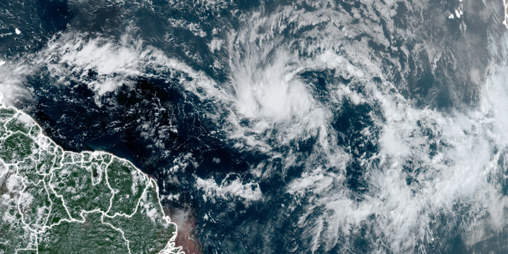
Tropical Storm Beryl formed in the Atlantic east of the Windward Islands on June 28, 2024. This is the second named storm of the Atlantic hurricane season to form this early in the year. The storm could potentially strengthen into a hurricane by Sunday, bringing heavy rain, hurricane force winds, and dangerous storm surge and waves to the Windward Islands late Sunday and into Monday morning.
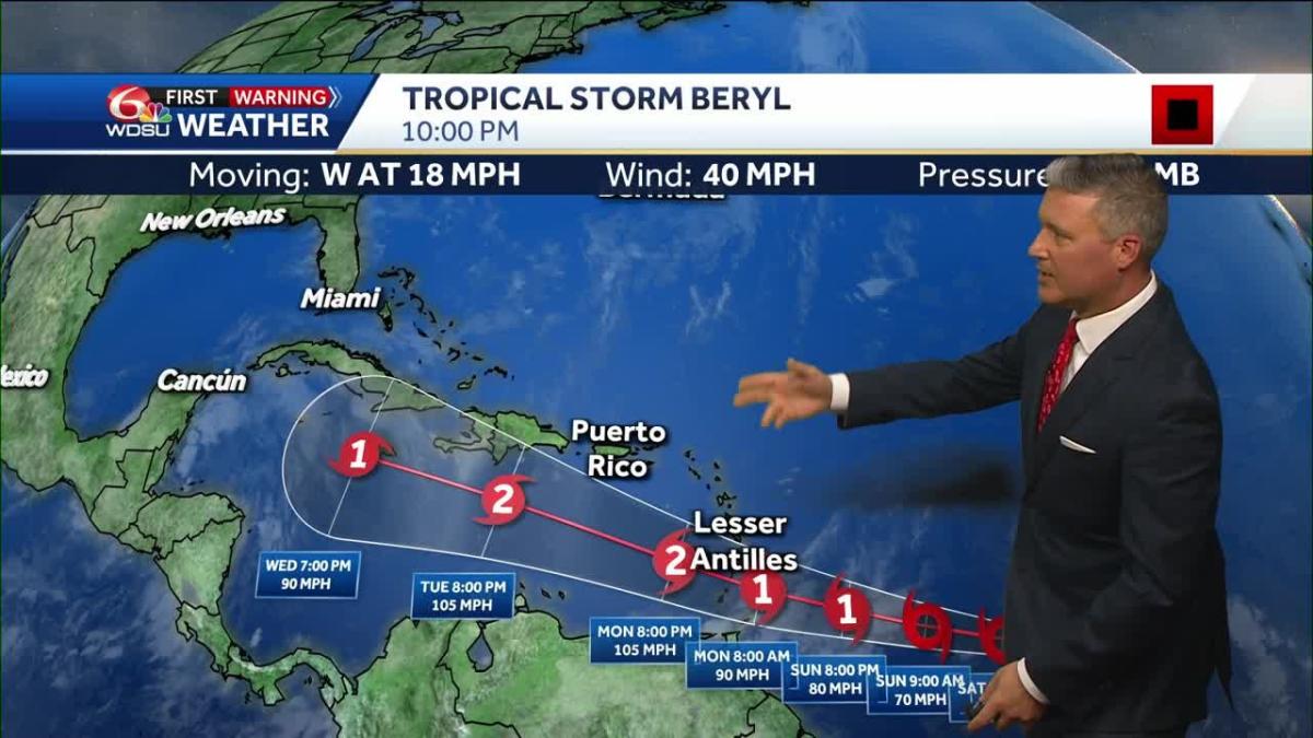
According to multiple sources including the National Hurricane Center (NHC), Tropical Storm Beryl was moving westward with maximum sustained winds of 40 mph as of Friday evening advisory. The storm is expected to cross over the Windward Islands late Sunday and into Monday morning, potentially impacting Barbados and nearby islands.
The NHC forecast calls for Tropical Storm Beryl to be a hurricane by Sunday afternoon with maximum sustained winds potentially reaching up to 105 mph. However, atmospheric conditions typically not favorable for strengthening storms at this point in June, but some computer models suggest it could be a major hurricane before it reaches the Windwards.
The first named storm of the Atlantic hurricane season to form over the central or eastern tropical Atlantic this early in the year, breaking a record set in 1933. The farthest east a hurricane has formed in the tropical Atlantic.
Tropical Storm Beryl is expected to move into the Caribbean Sea by Sunday evening with winds potentially up to 105 mph. Some computer models suggest it could be a major hurricane before it reaches the Windwards, making this an important storm to monitor closely.
The NHC advises that residents in the Windward Islands and other potentially impacted areas should prepare for heavy rain, hurricane force winds, and dangerous storm surge and waves. Stay tuned for updates from reliable sources such as the National Hurricane Center.


