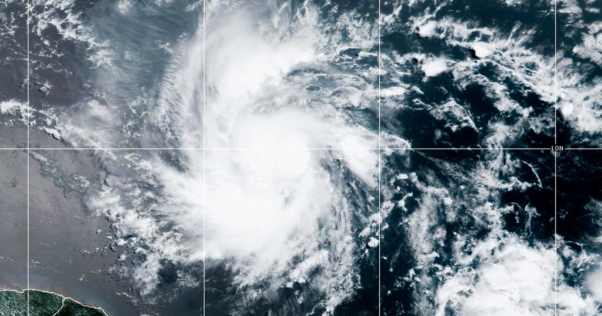
Tropical Storm Beryl, which formed in the Atlantic Ocean on June 28, 2024, has rapidly intensified into a major hurricane and is heading towards the Caribbean. According to multiple sources including NBC News, USA Today, Weather.com and Fox Weather,
Beryl is currently a Category 1 hurricane with maximum sustained winds of 75 miles per hour. It is expected to become a Category 3 or stronger hurricane before reaching the Windward Islands.
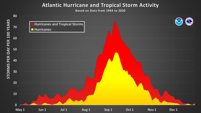
The storm formed earlier than usual, as the first hurricane of the season typically forms around August 11. However, record-warm ocean temperatures in the tropical Atlantic Ocean are contributing to its early formation and intensification.
Interests in Barbados, St. Lucia, St. Vincent and the Grenadines, Grenada, Martinique and Trinidad and Tobago should prepare for tropical storm or hurricane conditions as a Hurricane Warning has been issued for Barbados, St. Lucia, St. Vincent and the Grenadine Islands and Grenada.
A tropical storm warning is in effect for Martinique and Tobago.
Beryl will likely move into the eastern Caribbean Sea on Monday and take a general west-northwest track through the Fourth of July week. However, its future path in the western half of the Caribbean Sea is uncertain due to potential wind shear.
The National Hurricane Center forecasts that devastating wind damage is expected where the eyewall of Beryl moves through portions of the Windward Islands. Life-threatening storm surges may raise water levels by 5 to 7 feet above normal tide levels in hurricane watch areas and bring destructive waves to the coast.
Total rainfall of 3 to 6 inches is possible across Barbados and the Windward Islands Sunday into Monday, which may cause flooding in some areas. North of Beryl, 1 to 4 inches of rain is possible in parts of southeastern Puerto Rico Monday night into Tuesday.
Beryl formed further east than any other June hurricane since the mid-1800s and is a major threat to the Windward Islands.


