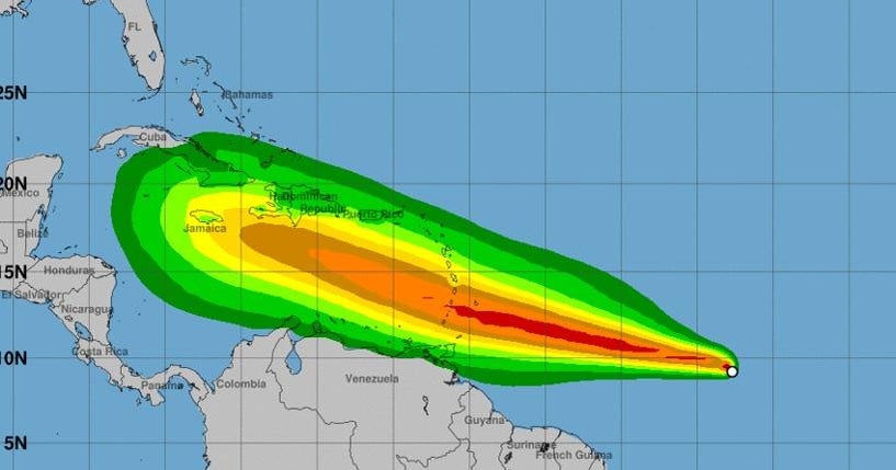
Tropical Storm Beryl, currently located in the Atlantic Ocean, is forecast to rapidly intensify into a major hurricane as it approaches the Windward Islands in the Caribbean Sea. According to multiple sources, including the National Hurricane Center (NHC), Beryl is expected to bring destructive hurricane-force winds and life-threatening storm surge when it makes landfall. The storm is currently moving west at about 23 mph with maximum sustained winds near 65 mph. However, it is predicted to strengthen significantly before reaching the Windward Islands late Sunday or Monday.
The NHC warns that hurricane watches have been issued for the Windward Islands, including Barbados and St. Lucia, as well as Grenada and St. Vincent and the Grenadines, Martinique, and Tobago. Residents in these areas are urged to take necessary precautions to protect their property and ensure their safety.
Beryl is not the only tropical system being monitored in the Atlantic. The NHC is also tracking a disturbance named 94L, which has a 70% chance of developing into a tropical cyclone within the next five days. Additionally, there is another area of low pressure that could potentially develop into a tropical storm later this week.
The development of these systems comes as the Atlantic hurricane season is predicted to be above-average this year, with 17 to 25 named storms expected to form. Of these, four to seven are forecasted to become major hurricanes.
It is important for residents in the affected areas and those planning travel in the coming days and weeks to stay informed about the latest developments regarding Tropical Storm Beryl and any other potential tropical systems. The NHC provides regular updates on its website, as well as through social media channels.


