DFW Weather: Storms have moved in to North Texas with more on the way tonight. Here's the timing:
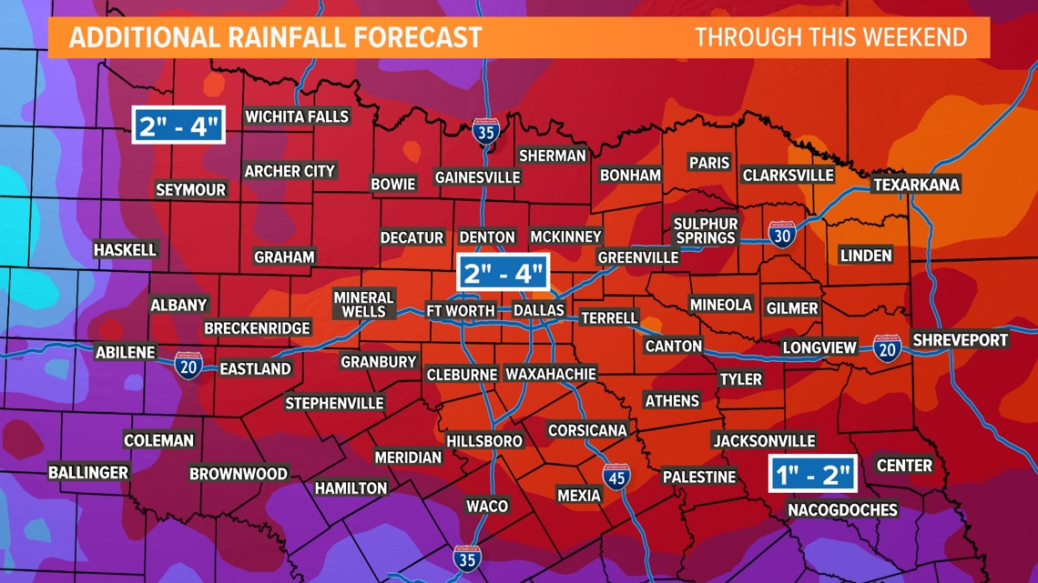
More storms are possible every day through the weekend. The pattern is unsettled, and each day and night's rain chances and timing will likely depend on what happened the day or night before. Quick Notes: Severe weather possible, rain and storm chances every day through the weekend, heavy rain could cause additional flooding.
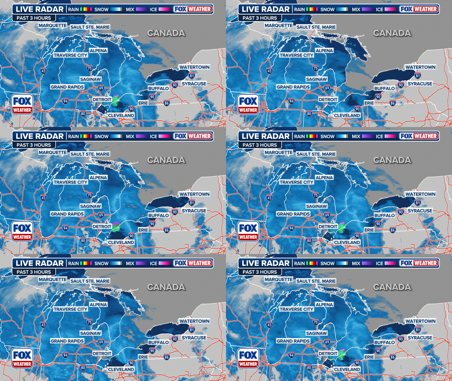
LIVE RADAR:
Thursday & Friday
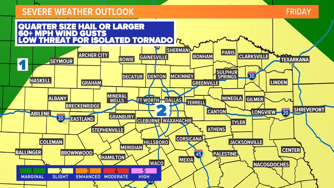
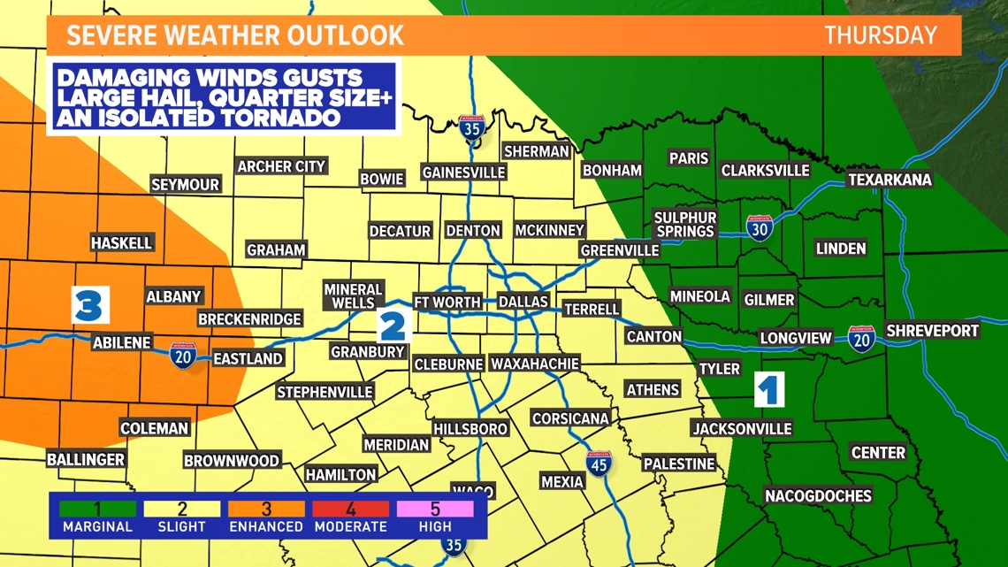
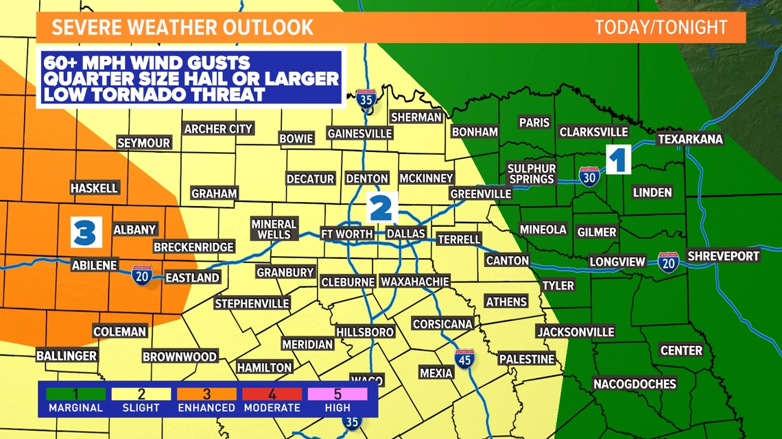
Thursday and Friday will feature rain somewhere in North Texas with a risk for thunderstorms to be strong to severe. It won't fall all at once, but any heavy rain that falls could cause flooding issues in places. The severe threat will vary day by day, with a Slight Risk (level 2 out of 5) for both Thursday and Friday. With multiple rounds of thunderstorms moving through the area, quarter size hail or larger and 60 mph wind gusts will be possible. The tornado threat looks low, but not zero.
Here's a look at the timing Thursday:
The first round of storms will last through the early afternoon with a break Thursday evening, before the next round arrives overnight Thursday into Friday. Confidence is highest in that round.
Here's a look at the timing Friday:
it does look like the next round of storms will move in late Thursday into Friday morning. For DFW, storms will likely move in after 10pm with the most active period between midnight at 4am. The main threats here will be strong winds along the leading edge of the line of storms. Heavy rain leading to additional flooding will also be a concern. There is a chance for quarter size hail, but that threat looks isolated. The tornado threat is low, but not zero.
Rain Totals
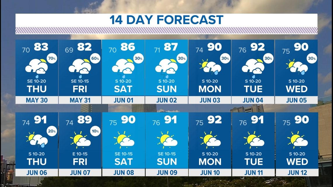
14-Day Forecast We need the pattern to calm down, and we may start that shift in the second week of June. Hang in there, North Texas.
